
Description
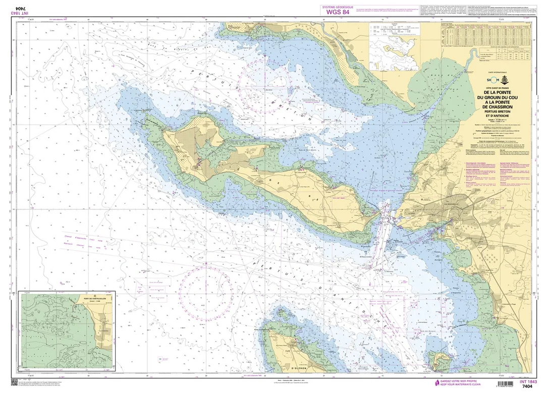
Seekarte Shom 7404 – De la Pointe du Grouin du Cou à la Pointe de Chassiron
Die amtliche französische Seekarte Shom 7404 deckt das Gebiet De la Pointe du Grouin du Cou à la Pointe de Chassiron ab und ist im Maßstab 1:50.000 ausgeführt. Als Küstenkarte eignet sie sich für die Navigation entlang der Küste und das Anlaufen von Häfen.
Die französische Mittelmeerküste zwischen spanischer Grenze und Monaco umfasst den Golfe du Lion, die Reede von Marseille, die Îles d’Hyères und die Côte d’Azur. Im Golfe du Lion ist der Mistral der prägende Wind. Die Karte enthält zusätzlich Detaildarstellungen zu Pertuis Breton et d’Antioche.
Die Karte wird im Print-on-Demand-Verfahren gedruckt. Sie erhalten dadurch stets die aktuelle Ausgabe mit den neuesten amtlichen Berichtigungen. Ausführung: Maßstab 1:50.000; Format A0; stabiles, wasserabweisendes Papier; Geodätisches Datum WGS 84.
Reviews
There are no reviews yet.